by Kandice Cross
Most of us have heard of Global Positioning System (GPS) technology and have come to rely on it to get us from point A to point B. The use of GPS technology extends well beyond giving users basic directions. For example, GPS tags have long been employed to tag and track a variety of fish and sea reptiles, which helps scientists learn more about species-specific movement and habits. By collecting this data, scientists can better advocate for management strategies that will improve conservation efforts.
What is GPS Anyway?

GPS began as a way for the United States Navy to track submarines and quickly became well-integrated within broader society. The technology has been used for everything from helping farmers with high-yield crop development and pest management to supporting wildlife management agencies in developing more accurate species protection practices. GPS has also become an integral component in transportation management systems, which have sought to increase dependability and efficiency. In addition, emergency response and natural disaster management organizations have come to rely heavily on the use of GPS—not only to aid in the delivery of essential medical support but also to use GPS data to increase the accuracy when predicting the occurrence of natural disasters.
Today, GPS is a collection of 30 satellites that orbit Earth. At any given moment, there are at least three satellites, often more, in the sky directly overhead. When using a GPS receiver, which can be a handheld GPS device or a smartphone app, we can use these satellites to help us determine our precise location, using latitude and longitude coordinates, anywhere on Earth’s surface.
What’s more, GPS devices have grown in popularity for use in recreational activities. Geocaching, for example, gives participants a chance to experience the thrill of a modern-day treasure hunt. Thanks to the immensely popular game Pokémon GO, the use of GPS to track and find digital prizes or locations has provided users with new fun and interactive ways to use the technology.
GPS and the Classroom
An obvious connection between GPS and the classroom might be to create a stand-alone lesson involving navigation using latitude and longitude coordinates. However, GPS can also easily be integrated into other lessons, with applications not only in geography classrooms, but also in the sciences, the social sciences, mathematics, and beyond.
By using a GPS device, students are able to mark and track their geographical locations. However, by merging this information with other data collected in the field—like ecology, urban planning, or statistics—students can make first-hand connections with the data that they have cultivated.
No GPS Device? No Problem!
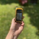
In the early days, to make use of GPS, a user would require an often costly receiver. While these devices have come down in price considerably, having 30 devices readily available for student use might still prove challenging. Enter the GPS smartphone app! These days, most classrooms will have several students who have access to a smartphone and, therefore, the opportunity to turn their phones into their very own GPS receiver. Currently, there are a plethora of GPS receiver apps available. If you are looking for a free, user-friendly program, Gaia GPS: Mobile Trail Maps is a great spot to start.
Getting Started – How to Use a GPS Device
The following is a list of steps that show how to download a GPS app to a smartphone in order to use a smartphone as a GPS device.
Step One: Download the Gaia GPS: Mobile Trail Maps app to your mobile device. The app is free from Apple’s App Store and Google Play.

Step Two: Once you open the app on your mobile device, the app will guide you through a list of preferences to help personalize your experience. For example, the app prompts the user to consider what they like to do outdoors. For the purpose of this activity, we recommend you select “Walking” from the list of activity choices (for example, users can choose “Hiking, Trail Running, or Backpacking”). Each choice you select will help customize the app experience. It also asks permission to access your precise location and select your preferred map layers view. The app will also prompt you to create an account. This is helpful to keep track of your journeys for future reference and is completely free.

Step Three: Your screen will now display a map with a large orange arrow representing your current location. To navigate to your first location, tap on the “+” icon located at the top right of the screen. Select “Add Waypoint” from the list of options.

Step Four: From here, enter the latitude and longitude coordinates of your destination. To add a waypoint, tap directly on the map. You must select two waypoints to create a “Route”. You may also wish to give your location an appropriate title, for example “My First Waypoint” or “Home.” Finish by tapping “Save” in the top right corner. When you tap on the screen, a prompt will appear that allows you to either “Name Waypoint” or “Delete Route Point”.

Step Five: You will now return to the map home screen, only this time you should see a red pin indicating your marked waypoint on the map. By tapping on the red pin, you will see a screen pop up at the bottom of your map. Here, tap on the “More” button.

Step Six: A pop-up menu will now appear. From here, select “Guide Me”. A black information bar will appear at the top of your map showing you the distance in metres to the waypoint and the direction in which you are heading.

Step Seven: Start walking!
Benefits of Using GPS in the Classroom
Give Students a Head Start
GPS is widely integrated in technology in society. Helping students become familiar with the basics of GPS can give them an understanding for all the ways it is integrated into our society through widely used devices (such as a smartphone).
STEM in the Classroom
Looking for a meaningful way to integrate STEM (Science, Technology, Engineering, and Mathematics) into any classroom? With a little bit of creativity, GPS can be used to suit the needs of any subject, not just traditional STEM subject areas. For example, students might write a story set within their community. They can then record the locations of the most important events in the story and use them to create an accompanying map.
Get Students Outside
Sometimes, the best lessons happen outside the classroom. Regardless of the season, a GPS lesson provides the chance for students to get outside, build teamwork skills, and most importantly, have fun!
GPS Lessons and Resources
- Introduction to GPS and GPS Devices – This lesson introduces students to the basic concepts of GPS, followed by guiding students through a fun scavenger hunt while learning to use a GPS device in the field
- Teaching Directions, Maps, and Coordinates – This is a great introductory lesson that can be geared towards students of younger ages
- Making Art with GPS – This lesson takes GPS to the next level by having students create their own works of art using GPS technology
- 10 Ready-to-Go GPS Lessons – These 10 ready-to-go GPS lessons include a “Hide and Seek” activity and an “Amazing Race” challenge!
Sources
- Admin. “Applications of GPS in Disaster Management—GIS Sensing.” GIS Sensing, 25 Feb. 2020.
- “Global Positioning System History.” NASA, 2014.
- “Making GPS Art: Draw It, Walk It, Log It, Display It!” TeachEngineering.org, 17 June 2022.
- Parma, Jenny. “Lesson 5: Teaching Directions, Maps, and Coordinates.” Edutopia, George Lucas Educational Foundation, 21 Jan. 2009.
- “Precision, Geospatial and Sensor Technologies Programs.” National Institute of Food and Agriculture, 2019.
- The Science Spot, 2022.
- TrailBehind. “Gaia GPS: Mobile Trail Maps.” App Store, 22 May 2017.
- Weinlich, Michael, et al. “Significant Acceleration of Emergency Response Using Smartphone Geolocation Data and a Worldwide Emergency Call Support System.” PLOS ONE, edited by Yu Ru Kou, vol. 13, no. 5, May 2018, p. e0196336.
This article originally appeared in the sixth issue of Root & STEM, Pinnguaq’s free print and online STEAM resource supporting educators in teaching digital skills

