
Introduction
We will explore the goals of cartography by designing and creating our own fantasy maps for offline gaming such as a homemade board game.
Cartographers make maps or charts that visually depict the geography of an environment such as the location of landmasses, roads, bodies of water, biomes, etc. depending on the goal of the map. A map of the earth often shows the different continents, islands, boundaries between countries, the capital cities, the equator, and much more. For example, an avid hiker/cyclist would be interested in a topography map that shows the changes in elevation in a certain area so they would know the difficulty of the route ahead. The weather forecast uses maps that depict the pressure and speed and temperature on a map to show us how they predict the weather will look for the week. Just like how maps can show physical characteristics of a location, maps can also show political information, such as provincial/state boundaries, population size, and social trends. It all depends on the purpose of the information you wish to display.

In video games, maps help players navigate and immerse themselves in the world and challenges that lie therein. They can show players the boundaries and characteristics of the world and help decide where to explore next. In early gaming such as Super Mario Brothers 3, players navigated from each numbered level which helped players visualize how many levels needed to reach the goal– the distressed princess in her castle. The map is characterized by different environments that depict how each level would look and the challenges associated with each level. If the level was located on a body of water, this would typically indicate that the level would take place either underwater or above water and would feature water-based enemies such as fish, crabs, and evil squids.
In Minecraft, players explore an open-world map that depicts different regions and biomes. The purpose of showing the different biomes gives players an idea of where to find different resources unique to that biome, such as cocoa beans only being found in jungle biomes. Settlers of Catan uses a map that consists of tiles that represent 6 distinct types of terrain. Each tile yields players different resources such as wheat from wheat fields, stone yielded from a quarry, sheep from pastures, etc. The purpose of using such a map is because the goal of the game is to strategically collect resources needed to build settlements and trade with other players.
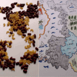
We will use dried beans, rice, sand, or rocks to help us make imaginary continents, islands and oceans for our fantasy world maps. Using our knowledge of climate, biomes and geography we will imagine the environments of each place and corresponding designs associated with them.
Vocabulary
Cartography - The art or technique of making maps or charts.
Biome - A biome is an area either terrestrial or marine that is described by the species of plants or animals that have adapted and evolved to live in that environment. The climate of the area has an impact on the species that can develop.
An example of how biomes can be categorized:
- Forest
- Grassland
- Freshwater
- Marine
- Desert
- Tundra
- A Climate System– Has 5 major components that constantly interact with each other, recycling energy and chemical elements needed for life, to form a climate type.
- Atmosphere (air)
- Hydrosphere (water)
- Cryosphere (ice and permafrost)
- Lithosphere (earth’s upper rocky layer)
- Biosphere (living things)
- Climate types:
- Tropical
- Dry
- Temperate
- Continental
- Polar
- Continent- A continent is a very large division of landmass. Earth has 7 continents- North America, South America, Europe, Africa, Asia, Australia and Antarctica.
- Island- An island is a smaller landmass surrounded by water. Some islands are considered part of a continent, for example, Greenland is earth’s largest island and is considered part of the North American continent although it is politically associated with Europe.
- Isthmus- An isthmus is a narrow strip of land that connects two larger landmasses.
Materials
Please list any materials needed in order to complete the tutorial.
- Dried foods – beans, lentils, rice, pasta noodles
- OR sand, small rocks or pebbles
- Colored pencils
- Pens or markers
- Paper
Step 1
Assemble your materials and place your sheet of paper on a clear workspace.
Step 2
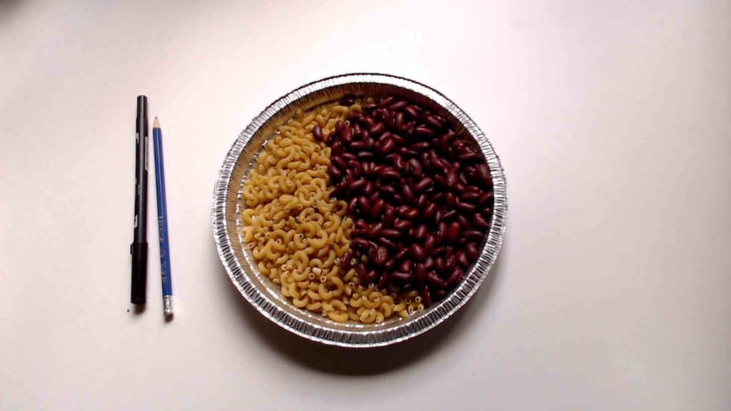
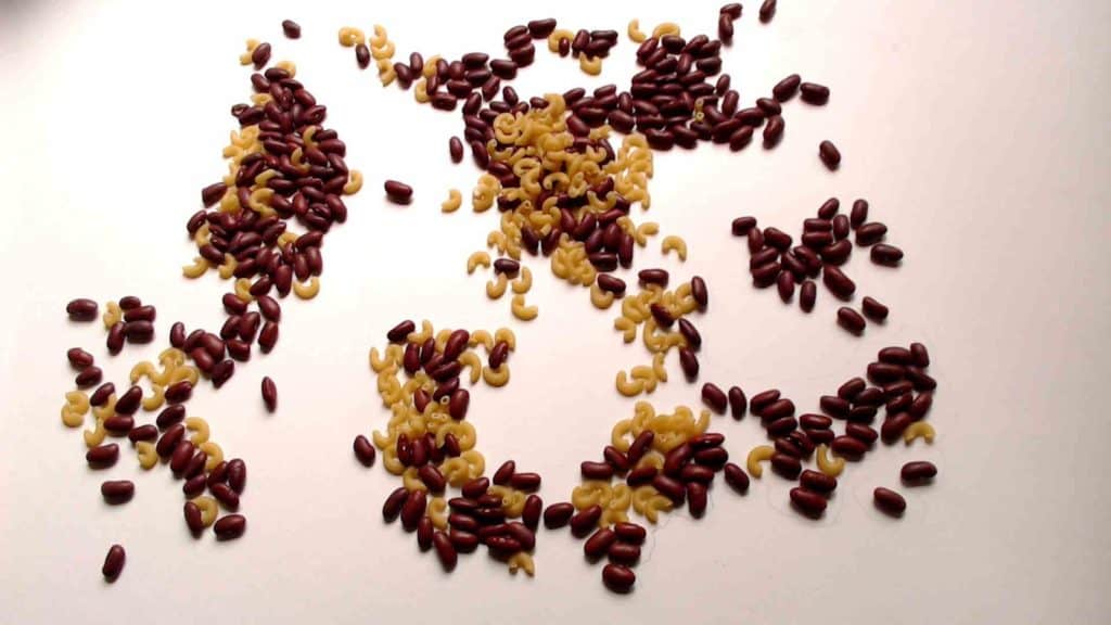
Pour your chosen materials onto the sheet of paper, move the materials around to make different shapes that will represent continents and islands.
Step 3
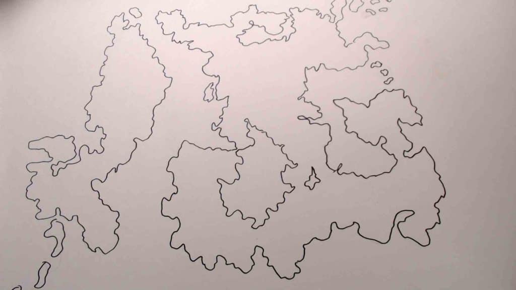
Once you’re happy with the placement of your materials, trace around the outline of the shapes using a pencil.
Step 4
Remove the materials to reveal your design. If you used dry foods, don’t throw them away! Store them or cook them into a tasty meal to avoid wasting food.
Step 5
Now we must design our maps to show the different characteristics of each continent or island. We can make more than one map to show different information. A good place to start is to define the biomes and therefore the resources found in each place. Add physical traits to your map such as the terrain. How many different biomes will your fantasy world have and how are they different? What characterizes these biomes? Can you combine different biomes?
What kind of obstacles can we add to our map? We could add obstacles such as a dusty sandstorm in a desert biome blocking our way or a tropical rainforest with spiky vines. What kind of enemies exist in this environment? Different biomes can depict different advantages or challenges in a game. How does this affect the gameplay and player experience?
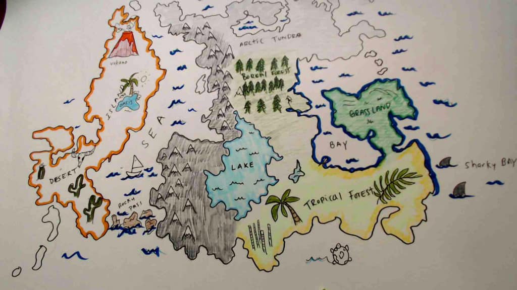
Here we have a finished map with different regions, continents and biomes. Each biome is represented with terrain unique to that region.
Computer Activity
Okay cartographers! It’s time to do some research about the biomes that we will use to inform players in our game.
Using this website about biomes we can find useful information about plants and animals, terrain and climate of each respective biome found in our maps.
Example:
Arctic Tundra
Climate: very cold and dry
Animals: migratory birds, caribou, musk ox, arctic foxes
Plants: not much diversity, mostly small shrubs, lichen,
Do research about each biome in your fantasy world. Note the Types of terrain that make up the regions and climate. This research will help us later for our game development.
Conclusion
We want to see the awesome things you’re creating! Take a photo or video and share your work with us by emailing media@pinnguaq.com or tagging @pinnguaq on Facebook, Twitter, or Instagram. Don’t forget to include the hashtag #LearnWithPinnguaq! If Scratch Project: You can also upload your project to the Pinnguaq Studio.
Resources
Additional Resources
This might include (but is not limited to) websites, books, games, apps, organizations or companies that produce relevant work, YouTube videos, or content that Pinnguaq produces.
- MBGnet Taiga
- Biome definition by National Geographic
- Tips for Building Beautiful Terrain- Roblox
- GeoGuessr
Social Media Resources
Are there any interesting subject experts that students might want to follow? Learning from professionals working in the respective field is a great opportunity for students to learn.
You might also like
Maanazaadi Medicine
 June 30, 2020
Courtney Milne, a digital steward at Pinnguaq, writes about Maanazaadi medicine.
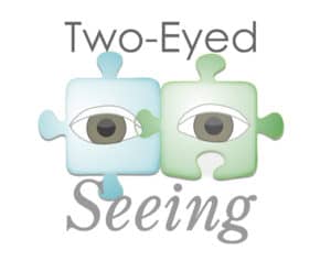
Using Twine to Understand our Responsibilities to Mother Earth: Environmental Protection from a Two-Eyed Seeing Perspective
 Grade 7 – Grade 12
In this lesson we introduce students to the Two-Eyed Seeing or Etuaptmumk Framework, created by Mi’kmaw Elder Albert Marshall.
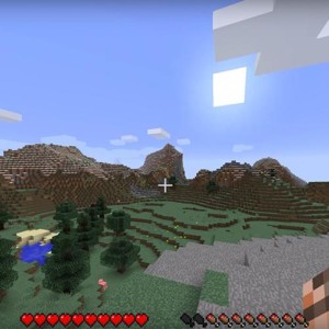
Introductory Minecraft Video Walkthrough
Grade 5 – Grade 8
Would you love to play Minecraft but have no working knowledge of the game itself? Here we discuss key aspects of the game through three videos on how to survive in Minecraft!
